


UpdatedOct 10, 2020
PublishedOct 10, 2020
Packagecom.dom925.mapvue
MD51eed4ca9448ea807b7bd38d1e09e66c7
SHA1 (signer)E5:9D:19:FD:8D:A4:3A:AF:CD:14:FF:7A:C8:C2:21:93:15:E5:49:67
Signed byCN=Dominic Chin, C=SG
Malware scanTRUSTED
Contact[email protected]
Privacy policyView
What's new
Add GDPR setting
Description
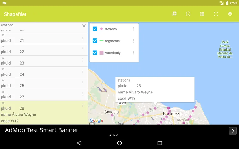
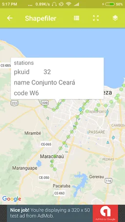
This app can load and display one or more ESRI Shapefiles with Google Maps as the base map. The overlay colors are randomly assigned by the app, but the user can bring up the layer properties to adjust the colors, opacity, and text labels. Polygon, line, point and text label features are clickable; once tapped, a snippet balloon will be displayed - a further tap will display the data attributes of the feature.
Only a limited set of source coordinate system types is available for this version, namely Geographic, and common projections like UTM, State Plane, Cassini-Soldner, Mercator, Transverse Mercator, with a choice of geodetic datums including WGS84. Unfortunately, user defined projection parameters are not available yet. Prj files are currently not used too.
The app will automatically remember the Shapefiles and layer properties without the user having to explicitly save the settings.
Required features
- Faketouch android.hardware.faketouch
- Wifi android.hardware.wifi
Permissions (7)
Shapefiler requests the following Android permissions:
- Access Network State android.permission.ACCESS_NETWORK_STATE
- Access Wifi State android.permission.ACCESS_WIFI_STATE
- Internet android.permission.INTERNET
- Read External Storage android.permission.READ_EXTERNAL_STORAGE
- Write External Storage android.permission.WRITE_EXTERNAL_STORAGE
- Com Dom925 Mapvue Permission Maps Receive com.dom925.mapvue.permission.MAPS_RECEIVE
- Providers Gsf Permission Read Gservices com.google.android.providers.gsf.permission.READ_GSERVICES