TrekMe - GPS trekking offline
Offline maps & GPS tracker for hiking, biking. Zero tracking, high battery life.
peterLaurence · com.peterlaurence.trekme


UpdatedApr 15, 2026
PublishedDec 19, 2020
Packagecom.peterlaurence.trekme
MD56c3e8cd7e9b8b1d4760ccd5881a2152b
SHA1 (signer)21:3D:50:18:17:D8:E1:F9:A8:E9:38:E6:91:75:D6:E3:46:07:34:6C
Signed byCN=peterLaurence, L=Yerres, ST=France, C=33
Architecturesx86, x86-64, armeabi-v7a, arm64-v8a
Malware scanTRUSTED
Contact[email protected]
Privacy policyView
What's new
5.1.2
• New marker icons (fruits, animals, castle, etc.)
• Ergonomic improvements.
• Add an option to display locations in Degrees Minutes Seconds.
• The map is now displayed full screen. The recording button has been moved to the bottom left of the screen.
• New marker icons (fruits, animals, castle, etc.)
• Ergonomic improvements.
• Add an option to display locations in Degrees Minutes Seconds.
• The map is now displayed full screen. The recording button has been moved to the bottom left of the screen.
Description
Explore the wilderness without limits.
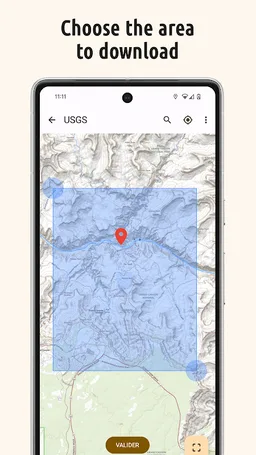
TrekMe turns your phone into a reliable, offline GPS navigator. Whether you are trekking, biking, or mountaineering, get your live position on topographic maps. Download the maps you need, and then navigate without an internet connection.
🔒 100% Privacy Oriented
We believe your location is your business. TrekMe features zero tracking. Your data never leaves your device, and you are the only one who knows where you go.
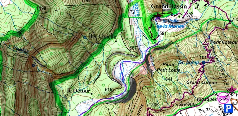
🌍 Download Offline Maps
Create your own maps by selecting the area you need. Once downloaded, they are available completely offline—perfect for dead zones.
• Supported Sources: USGS, OpenStreetMap, SwissTopo, IGN (France and Spain).
• Storage Friendly: Save heavy maps to your SD card to free up internal memory.
🔋 Built for Endurance
Don't worry about your battery dying mid-hike. TrekMe is engineered for efficiency, ensuring fluid performance with ultra-low battery usage.
Key Features
• 📍 Navigation: View your live position, orientation, and speed.
• 👣 GPX Manager: Import, record, and share tracks in GPX format.
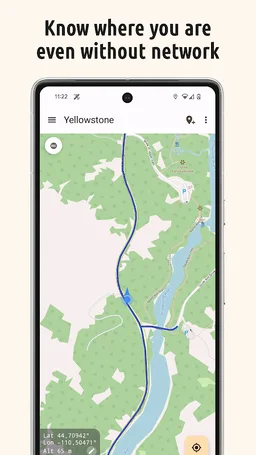
• 📈 Real-time Stats: Visualize distance, elevation, and speed while recording.
• 🖍️ Markers: Add POIs (Points of Interest) with comments and photos on the map.
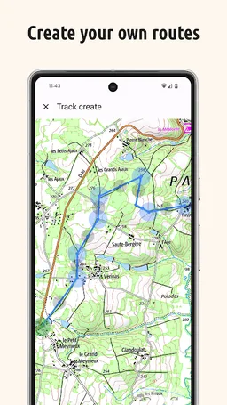
• 📏 Planning: Create tracks manually and measure distances between points.
🚀 Unlock Premium
Take your adventure further with advanced tools:
• Safety Alerts: Get notified when you stray from your track or approach specific locations.
• Unlimited Maps: No size limits for map downloads.
• Pro Tools: Edit tracks (split/merge), fix missing map tiles, and access HD OpenStreetMaps.
• Organize Limitlessly: Create unlimited folders to perfectly structure and manage all your recorded tracks.
• Official French Topo Maps: Access the gold standard for hiking in France (IGN).
📡 For Professionals & Enthusiasts
Need high-precision data? Connect an external Bluetooth GPS(*) to TrekMe.
• Bypass internal GPS for higher accuracy.
• Ideal for aeronautics, professional topography, and high-frequency location updates.
(*) Supports NMEA over Bluetooth
User Guide & Support
https://github.com/peterLaurence/TrekMe/blob/master/Readme.md
TrekMe turns your phone into a reliable, offline GPS navigator. Whether you are trekking, biking, or mountaineering, get your live position on topographic maps. Download the maps you need, and then navigate without an internet connection.
🔒 100% Privacy Oriented
We believe your location is your business. TrekMe features zero tracking. Your data never leaves your device, and you are the only one who knows where you go.
🌍 Download Offline Maps
Create your own maps by selecting the area you need. Once downloaded, they are available completely offline—perfect for dead zones.
• Supported Sources: USGS, OpenStreetMap, SwissTopo, IGN (France and Spain).
• Storage Friendly: Save heavy maps to your SD card to free up internal memory.
🔋 Built for Endurance
Don't worry about your battery dying mid-hike. TrekMe is engineered for efficiency, ensuring fluid performance with ultra-low battery usage.
Key Features
• 📍 Navigation: View your live position, orientation, and speed.
• 👣 GPX Manager: Import, record, and share tracks in GPX format.
• 📈 Real-time Stats: Visualize distance, elevation, and speed while recording.
• 🖍️ Markers: Add POIs (Points of Interest) with comments and photos on the map.
• 📏 Planning: Create tracks manually and measure distances between points.
🚀 Unlock Premium
Take your adventure further with advanced tools:
• Safety Alerts: Get notified when you stray from your track or approach specific locations.
• Unlimited Maps: No size limits for map downloads.
• Pro Tools: Edit tracks (split/merge), fix missing map tiles, and access HD OpenStreetMaps.
• Organize Limitlessly: Create unlimited folders to perfectly structure and manage all your recorded tracks.
• Official French Topo Maps: Access the gold standard for hiking in France (IGN).
📡 For Professionals & Enthusiasts
Need high-precision data? Connect an external Bluetooth GPS(*) to TrekMe.
• Bypass internal GPS for higher accuracy.
• Ideal for aeronautics, professional topography, and high-frequency location updates.
(*) Supports NMEA over Bluetooth
User Guide & Support
https://github.com/peterLaurence/TrekMe/blob/master/Readme.md
Required features
- Bluetooth android.hardware.bluetooth
- Faketouch android.hardware.faketouch
- Location android.hardware.location
- Wifi android.hardware.wifi
Permissions (21)
TrekMe - GPS trekking offline requests the following Android permissions:
- Access Background Location android.permission.ACCESS_BACKGROUND_LOCATION
- Access Coarse Location android.permission.ACCESS_COARSE_LOCATION
- Access Fine Location android.permission.ACCESS_FINE_LOCATION
- Access Network State android.permission.ACCESS_NETWORK_STATE
- Access Wifi State android.permission.ACCESS_WIFI_STATE
- Bluetooth android.permission.BLUETOOTH
- Bluetooth Connect android.permission.BLUETOOTH_CONNECT
- Camera android.permission.CAMERA
- Change Network State android.permission.CHANGE_NETWORK_STATE
- Change Wifi State android.permission.CHANGE_WIFI_STATE
- Foreground Service android.permission.FOREGROUND_SERVICE
- Foreground Service Data Sync android.permission.FOREGROUND_SERVICE_DATA_SYNC
- Foreground Service Location android.permission.FOREGROUND_SERVICE_LOCATION
- Internet android.permission.INTERNET
- Nearby Wifi Devices android.permission.NEARBY_WIFI_DEVICES
- Post Notifications android.permission.POST_NOTIFICATIONS
- Receive Boot Completed android.permission.RECEIVE_BOOT_COMPLETED
- Vibrate android.permission.VIBRATE
- Wake Lock android.permission.WAKE_LOCK
- Com Android Vending Billing com.android.vending.BILLING
- Com Peterlaurence Trekme Dynamic Receiver Not Exported Permission com.peterlaurence.trekme.DYNAMIC_RECEIVER_NOT_EXPORTED_PERMISSION