
SmartCity Budapest Transport
Free OFFLINE public transport route planner and timetable.
Ponte.hu · hu.ponte.mobile.smartcity


UpdatedApr 12, 2020
PublishedApr 12, 2020
Packagehu.ponte.mobile.smartcity
MD56bdc4bfb26412b0cde3a6550311ab3af
SHA1 (signer)33:1B:FF:B5:88:85:88:CB:A7:B4:66:84:F1:39:49:62:45:B9:FE:7D
Signed byCN=Ponte.hu Kft, OU=hu, O=ponte, L=Budapest, ST=Budapest, C=36
Architecturesx86, x86-64, armeabi, armeabi-v7a, arm64-v8a, mips, mips64
Malware scanTRUSTED
Websitehttp://smartcity.hu/
Contact[email protected]
Privacy policyView
What's new
Memory optimization
Performance optimization
Fix UI bugs
Fix system bugs
Performance optimization
Fix UI bugs
Fix system bugs
Description
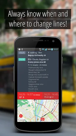
SmartCity is a totally free, OFFLINE public transport information application for Budapest. SmartCity offers a vector based map with address search, a public transport route planner and the full schedule of all the public transport lines of Budapest. The full functionality of SmartCity can be used offline.
Key features:
• Modern easy to use user interface based on out 6 years experience on mobile public transport applications.
• Offline full timetable of public transport lines including bus, metro, tram, train, suburban train and night lines.
• Timetable data based on the public official GTFS feeds of BKK ( Centre for Budapest Transport)
• Offline map based on OpenStreetMap data.
• Visualization of planned route on the map, with vehicle types and connections and visualization of any public transport line with stops
• Ease-of-use offline route planning from current position or from a selected location at any given time with alternative routes
• Offline address database for a quick address search and reverse geocode
• Using current time and position, the routes and timetables of near-by lines can be visualized
• Automated route planning to all favorite destination without network traffic
To use SmartCity Android 2.3 is required, Android 4.0 or better is recommended.
Required features
- Screen Portrait android.hardware.screen.portrait
Permissions (6)
SmartCity Budapest Transport requests the following Android permissions:
- Access Coarse Location android.permission.ACCESS_COARSE_LOCATION
- Access Fine Location android.permission.ACCESS_FINE_LOCATION
- Access Network State android.permission.ACCESS_NETWORK_STATE
- Internet android.permission.INTERNET
- Read External Storage android.permission.READ_EXTERNAL_STORAGE
- Write External Storage android.permission.WRITE_EXTERNAL_STORAGE

