
RealEarth
Map-based access to near-realtime satellite data and other geophysical products.
UW-Madison Space Science · edu.wisc.ssec.realearth


UpdatedMar 12, 2020
PublishedMar 12, 2020
Packageedu.wisc.ssec.realearth
MD501a3948a41867bbd97b98ccc501f2314
SHA1 (signer)6E:8F:2A:C3:43:10:D5:D5:4F:16:FE:7D:E8:2E:26:FB:E2:21:60:A5
Signed byCN=University of Wisconsin - Madison, OU=Graduate School, O=Space Science and Engineering Center, L=Madison, ST=WI, C=US
Malware scanTRUSTED
Contact[email protected]
Privacy policyView
Description
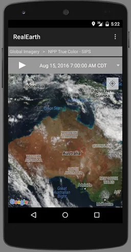
The RealEarth app provides access to real-time imagery and data products hosted by the University of Wisconsin - Madison Space Science and Engineering Center (SSEC). These products include global and regional remotely sensed atmospheric, terrestrial, and oceanographic imagery, observations of local meteorological parameters, and short-range predictions of future conditions. Features include:
- Select products to display by category, name, and time
- Pan and zoom map interface dynamically
- Display current location on map
- Animate by relative or absolute time steps
- Save custom favorites
Future enhancements will include capabilities for users to create custom geographic areas that will denote notification regions. Events such as severe weather, floods and fires will trigger a notification message directly to the user's mobile device.
Required features
- Faketouch android.hardware.faketouch
- Location android.hardware.location
Permissions (7)
RealEarth requests the following Android permissions:
- Access Coarse Location android.permission.ACCESS_COARSE_LOCATION
- Access Fine Location android.permission.ACCESS_FINE_LOCATION
- Access Network State android.permission.ACCESS_NETWORK_STATE
- Internet android.permission.INTERNET
- Read External Storage android.permission.READ_EXTERNAL_STORAGE
- Write External Storage android.permission.WRITE_EXTERNAL_STORAGE
- Providers Gsf Permission Read Gservices com.google.android.providers.gsf.permission.READ_GSERVICES