
Mapová aplikace VLS ČR
Vojenské lesy a statky ČR, s.p. · cz.vls.vojenskelesy


UpdatedAug 12, 2020
PublishedAug 12, 2020
Packagecz.vls.vojenskelesy
MD5477d0bade58e800ca91c78b282e1df21
SHA1 (signer)DD:79:F8:39:AA:DB:48:AA:15:DF:27:0B:9A:98:AF:41:8E:C2:49:07
Signed byO=Vojensk? lesy a statky ?R s.p., C=CZ
Malware scanTRUSTED
Websitehttp://vls.cz/
Contact[email protected]
What's new
Děkujeme za vaše připomínky. Aktualizace odstraňuje reporting chyb a pádů apliakace.
Description
Mobilní aplikace Vojenských lesů a statků vám umožní se dokonale orientovat ve dvou unikátních přírodních oblastech, které desítky let sloužily pouze k výcviku armády a dnes jsou přístupné veřejnosti.
Bývalý vojenský újezd Ralsko se rozkládá na 28 tisících hektarech na pomezí Středočeského a Libereckého kraje mezi Bezdězem a Ještědským hřebenem a lesnatá oblast v Severočeské pískovcové plošině je krajem borovic, skal, rybníků a domovem vlků i zubrů.
Další soubor pak podrobně mapuje oblast středních Brdy jihozápadně od Prahy – oblast bývalého vojenského újezdu, která se po devadesáti letech v roce 2016 otevřela veřejnosti jako Chráněná krajinná oblast Brdy.
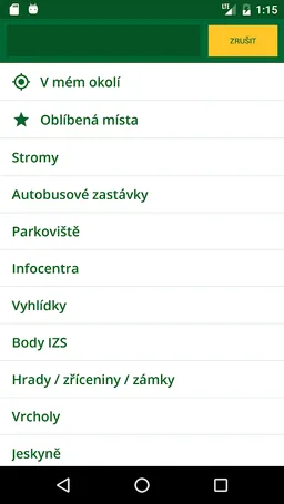
Mapová aplikace vedle turistických tras, dopravní sítě, zajímavých turistických míst, památek a vyhlídek obsahuje také encyklopedii vzácných rostlinných a živočišných druhů, které v těchto unikátních přírodních lokalitách najdete, lokace památných a významných stromů, ale také informace o zaniklých obcích a historii. Součástí aplikace je podrobný popis míst, dominant i přírody doplněný fotodokumentací.
Mobile Applications Military Forests and Farms allows you to be perfectly oriented in two unique natural areas, which for decades served only to train the army and are now open to the public.
The former military training area Ralsko is situated on 28 thousand hectares on the border of Central Bohemia and Liberec region between Bezdězem and Ještěd ridge and forest areas in the North sandstone plateau is a region of pines, rocks, ponds and home to wolves and bison.
More then file detailed maps of the Central Brdy southwest of Prague - the area of the former military area, which after ninety years in 2016 opened to the public as a protected landscape area Brdy.
Mapping applications in addition to hiking trails, roads, interesting tourist sites, monuments and prospects also contains an encyclopedia of rare plant and animal species in these unique natural areas can be found, the location memorable and significant trees, but also information about the extinct communities and history. The application includes a detailed description of the sites and landmarks of the nature complete with photographs.
Bývalý vojenský újezd Ralsko se rozkládá na 28 tisících hektarech na pomezí Středočeského a Libereckého kraje mezi Bezdězem a Ještědským hřebenem a lesnatá oblast v Severočeské pískovcové plošině je krajem borovic, skal, rybníků a domovem vlků i zubrů.
Další soubor pak podrobně mapuje oblast středních Brdy jihozápadně od Prahy – oblast bývalého vojenského újezdu, která se po devadesáti letech v roce 2016 otevřela veřejnosti jako Chráněná krajinná oblast Brdy.
Mapová aplikace vedle turistických tras, dopravní sítě, zajímavých turistických míst, památek a vyhlídek obsahuje také encyklopedii vzácných rostlinných a živočišných druhů, které v těchto unikátních přírodních lokalitách najdete, lokace památných a významných stromů, ale také informace o zaniklých obcích a historii. Součástí aplikace je podrobný popis míst, dominant i přírody doplněný fotodokumentací.
Mobile Applications Military Forests and Farms allows you to be perfectly oriented in two unique natural areas, which for decades served only to train the army and are now open to the public.
The former military training area Ralsko is situated on 28 thousand hectares on the border of Central Bohemia and Liberec region between Bezdězem and Ještěd ridge and forest areas in the North sandstone plateau is a region of pines, rocks, ponds and home to wolves and bison.
More then file detailed maps of the Central Brdy southwest of Prague - the area of the former military area, which after ninety years in 2016 opened to the public as a protected landscape area Brdy.
Mapping applications in addition to hiking trails, roads, interesting tourist sites, monuments and prospects also contains an encyclopedia of rare plant and animal species in these unique natural areas can be found, the location memorable and significant trees, but also information about the extinct communities and history. The application includes a detailed description of the sites and landmarks of the nature complete with photographs.
Required features
- Faketouch android.hardware.faketouch
- Location android.hardware.location
- Screen Portrait android.hardware.screen.portrait
Permissions (7)
Mapová aplikace VLS ČR requests the following Android permissions:
- Access Coarse Location android.permission.ACCESS_COARSE_LOCATION
- Access Fine Location android.permission.ACCESS_FINE_LOCATION
- Access Network State android.permission.ACCESS_NETWORK_STATE
- Access Wifi State android.permission.ACCESS_WIFI_STATE
- Internet android.permission.INTERNET
- Read External Storage android.permission.READ_EXTERNAL_STORAGE
- Write External Storage android.permission.WRITE_EXTERNAL_STORAGE