


UpdatedMar 27, 2026
PublishedJul 1, 2022
Packagecom.mapillary.app
MD5d30097d42f38a92aaa7bcbc35e162b94
SHA1 (signer)F8:6A:E6:40:FC:71:95:AB:34:E9:46:BD:78:FC:06:99:9A:67:96:33
Signed byCN=Mapillary AB, OU=Mapillary Mobile, O=Mapillary AB, L=Menlo Park, ST=California, C=US
Architecturesx86, x86-64, armeabi-v7a, arm64-v8a
Malware scanTRUSTED
Contact[email protected]
Privacy policyView
What's new
New Features:
* Pinch-to-zoom (preferring optical) on the camera screen (capped at 5x).
* Two-finger map rotation on map screens
* Compass button on the explore map
Minor Improvements:
* Smoother camera level line with reduced jitter
* Faster delete/report button response
* Coverage filter settings persist between sessions
* Sequence break distance reduced
* Homepage performance improvements
Bugs:
* Many fixes. Details are omitted due to word limit.
Description
Mapillary is the street-level imagery platform that scales and automates mapping using collaboration, cameras, and computer vision.
Anyone can capture images of any place, as often as needed, with any camera—including smartphones. Mapillary combines all images into a collaborative street-level view of the world that’s available for anyone to explore and use for improving maps, cities, and mobility. Computer vision technology provides a smooth viewing experience and speeds up mapping through machine-extracted map data.
Capturing with the Mapillary mobile app is the easiest way to join our contributor network. Let’s get started!
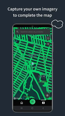
CREATE YOUR OWN STREET-LEVEL VIEWS
You control when and where to capture to create the freshest street-level imagery. Mapillary’s technology combines all images into a navigable view and blurs faces and license plates for privacy.
ACCESS AND OPEN UP DATA
Mapillary contributors are people, organizations, companies, and governments in 190 countries. Millions of images are added to the dataset every week, which you can explore right here in the mobile app.
MAKE BETTER MAPS
Use imagery and machine-extracted data to add details to maps and geospatial datasets. Mapillary integrates with tools like OpenStreetMap iD editor and JOSM, HERE Map Creator, and ArcGIS. To access the available map data, go to mapillary.com/app.
Anyone can capture images of any place, as often as needed, with any camera—including smartphones. Mapillary combines all images into a collaborative street-level view of the world that’s available for anyone to explore and use for improving maps, cities, and mobility. Computer vision technology provides a smooth viewing experience and speeds up mapping through machine-extracted map data.
Capturing with the Mapillary mobile app is the easiest way to join our contributor network. Let’s get started!
CREATE YOUR OWN STREET-LEVEL VIEWS
You control when and where to capture to create the freshest street-level imagery. Mapillary’s technology combines all images into a navigable view and blurs faces and license plates for privacy.
ACCESS AND OPEN UP DATA
Mapillary contributors are people, organizations, companies, and governments in 190 countries. Millions of images are added to the dataset every week, which you can explore right here in the mobile app.
MAKE BETTER MAPS
Use imagery and machine-extracted data to add details to maps and geospatial datasets. Mapillary integrates with tools like OpenStreetMap iD editor and JOSM, HERE Map Creator, and ArcGIS. To access the available map data, go to mapillary.com/app.
Required features
- Camera android.hardware.camera
- Faketouch android.hardware.faketouch
- Location android.hardware.location
- Location Gps android.hardware.location.gps
- Sensor Accelerometer android.hardware.sensor.accelerometer
Permissions (29)
Mapillary requests the following Android permissions:
- Access Coarse Location android.permission.ACCESS_COARSE_LOCATION
- Access Fine Location android.permission.ACCESS_FINE_LOCATION
- Access Network State android.permission.ACCESS_NETWORK_STATE
- Access Wifi State android.permission.ACCESS_WIFI_STATE
- Camera android.permission.CAMERA
- Change Wifi State android.permission.CHANGE_WIFI_STATE
- Foreground Service android.permission.FOREGROUND_SERVICE
- Foreground Service Data Sync android.permission.FOREGROUND_SERVICE_DATA_SYNC
- Internet android.permission.INTERNET
- Network android.permission.NETWORK
- Post Notifications android.permission.POST_NOTIFICATIONS
- Read External Storage android.permission.READ_EXTERNAL_STORAGE
- Read Sync Settings android.permission.READ_SYNC_SETTINGS
- Read Sync Stats android.permission.READ_SYNC_STATS
- Receive Boot Completed android.permission.RECEIVE_BOOT_COMPLETED
- System Alert Window android.permission.SYSTEM_ALERT_WINDOW
- Use Biometric android.permission.USE_BIOMETRIC
- Use Fingerprint android.permission.USE_FINGERPRINT
- Vibrate android.permission.VIBRATE
- Wake Lock android.permission.WAKE_LOCK
- Write External Storage android.permission.WRITE_EXTERNAL_STORAGE
- Write Sync Settings android.permission.WRITE_SYNC_SETTINGS
- C2dm Permission Receive com.google.android.c2dm.permission.RECEIVE
- Finsky Permission Bind Get Install Referrer Service com.google.android.finsky.permission.BIND_GET_INSTALL_REFERRER_SERVICE
- Gms Permission Activity Recognition com.google.android.gms.permission.ACTIVITY_RECOGNITION
- Gms Permission Ad Id com.google.android.gms.permission.AD_ID
- Launcher Permission Receive Launch Broadcasts com.google.android.launcher.permission.RECEIVE_LAUNCH_BROADCASTS
- Providers Gsf Permission Read Gservices com.google.android.providers.gsf.permission.READ_GSERVICES
- Com Mapillary App Dynamic Receiver Not Exported Permission com.mapillary.app.DYNAMIC_RECEIVER_NOT_EXPORTED_PERMISSION