
Green Tracks - hiking partner
You can import gpx file and display tracks on Google Maps.Support offline maps.
Sky Wang · com.mountain.tracks


UpdatedApr 25, 2026
PublishedApr 20, 2021
Packagecom.mountain.tracks
MD570d7696600ca865d6204de6a4397c500
SHA1 (signer)AA:25:01:BC:28:0F:01:CF:CC:52:F4:48:65:25:67:1E:E0:CD:C7:59
Signed byCN=Sky, OU=Outdoor, O=Outdoor, L=Taipei, ST=Taipei, C=TW
Architecturesx86, x86-64, armeabi-v7a, arm64-v8a
Malware scanTRUSTED
Contact[email protected]
Privacy policyView
What's new
1. Resolved an issue where a few mobile phones were unable to log in using their Google accounts.
2. Other bug fixes.
2. Other bug fixes.
Description
The core function of Green Tracks reads and analyzes the GPX, KML, KMZ and other track files in the mobile phone, and draws the analyzed content on the map. With the GPS satellite positioning, the user can know where he is in the track line. Reduce the risk of getting lost and can be used as a reference for outdoor activities such as mountain climbing and hiking.
•Supports Mapsforge offline map files
You can download the OpenAndroMaps world map directly in Green Tracks.
•Offline search
Install Mapsforge's POI file to search for points of interest offline.
•Supports offline maps in MBTiles format
Users can use Mobile Atlas Creator (MOBAC) to create MBTiles offline maps and select the MBTiles SQLite format. For offline map production methods, please refer to https://sky.greentracks.app/?p=2895
•Online map
You can use Google Road Map, Google Satellite Map, Google Hybrid Map, Google Terrain Map.
•Record tracks
Use Green Tracks to record your own journey. The recorded track lines can also be edited or merged, and the records can be saved in file formats such as GPX, KML or KMZ through the export function.
•Supports various types of track file formats
Green Tracks can parse track files in GPX, KML, KMZ and other file formats and display them on the map.
•Route planning
Supports BRouter, you can plan routes in Green Tracks and export them as GPX, KML or KMZ.
•Automatically return coordinates
By automatically returning coordinates or manually returning coordinates (network signal is required), those left behind can keep track of the traces at any time.
•Mark location
The coordinates reported by family members or friends can be marked on the map automatically or manually, making it easier to track their whereabouts.
•Coordinate conversion
WGS84 coordinate format conversion and TWD67, TWD97, UTM and other geodetic datum conversions.
•Off-track Alarm
During the process of recording the track, combined with the GPX file, you can use this function to avoid taking the wrong path.
•Backup and restore
Backup and restore self-recorded track records.
•Support HGT files
The HGT elevation file can be used to correct the altitude and improve the accuracy of the altitude.
•Photo map
Scan the photos on your phone and display them on the map to recall all the memories you took when you took them.
•Share your tracks
You can share your GPX records with other users, or download GPX files for tracking.
• Screenshot
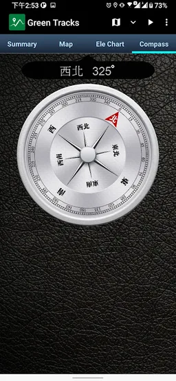
Take screenshots of the "Summary", "Map" and "Ele Chart" of the walking track and collage them into one photo for easy sharing on various online platforms.
•Supports overlapping maps
Green Tracks supports offline maps stacked on top of online maps, and offline maps stacked on top of offline maps.
•Collage track statistics and Photos
Combine activity statistics with waypoint photos or other photos as a photo.
•Supports Google Earth tour files
The records of the Green Tracks can be exported to kml or kmz files and provided with Google Earth Pro version (PC version) to record dynamic track videos. Video reference
https://youtu.be/f-qHKSfzY9U?si=MO7eQQVSHEyZ57DK
Our website
https://en.greentracks.app/
•Supports Mapsforge offline map files
You can download the OpenAndroMaps world map directly in Green Tracks.
•Offline search
Install Mapsforge's POI file to search for points of interest offline.
•Supports offline maps in MBTiles format
Users can use Mobile Atlas Creator (MOBAC) to create MBTiles offline maps and select the MBTiles SQLite format. For offline map production methods, please refer to https://sky.greentracks.app/?p=2895
•Online map
You can use Google Road Map, Google Satellite Map, Google Hybrid Map, Google Terrain Map.
•Record tracks
Use Green Tracks to record your own journey. The recorded track lines can also be edited or merged, and the records can be saved in file formats such as GPX, KML or KMZ through the export function.
•Supports various types of track file formats
Green Tracks can parse track files in GPX, KML, KMZ and other file formats and display them on the map.
•Route planning
Supports BRouter, you can plan routes in Green Tracks and export them as GPX, KML or KMZ.
•Automatically return coordinates
By automatically returning coordinates or manually returning coordinates (network signal is required), those left behind can keep track of the traces at any time.
•Mark location
The coordinates reported by family members or friends can be marked on the map automatically or manually, making it easier to track their whereabouts.
•Coordinate conversion
WGS84 coordinate format conversion and TWD67, TWD97, UTM and other geodetic datum conversions.
•Off-track Alarm
During the process of recording the track, combined with the GPX file, you can use this function to avoid taking the wrong path.
•Backup and restore
Backup and restore self-recorded track records.
•Support HGT files
The HGT elevation file can be used to correct the altitude and improve the accuracy of the altitude.
•Photo map
Scan the photos on your phone and display them on the map to recall all the memories you took when you took them.
•Share your tracks
You can share your GPX records with other users, or download GPX files for tracking.
• Screenshot
Take screenshots of the "Summary", "Map" and "Ele Chart" of the walking track and collage them into one photo for easy sharing on various online platforms.
•Supports overlapping maps
Green Tracks supports offline maps stacked on top of online maps, and offline maps stacked on top of offline maps.
•Collage track statistics and Photos
Combine activity statistics with waypoint photos or other photos as a photo.
•Supports Google Earth tour files
The records of the Green Tracks can be exported to kml or kmz files and provided with Google Earth Pro version (PC version) to record dynamic track videos. Video reference
https://youtu.be/f-qHKSfzY9U?si=MO7eQQVSHEyZ57DK
Our website
https://en.greentracks.app/
Required features
- Faketouch android.hardware.faketouch
- Location android.hardware.location
- Screen Portrait android.hardware.screen.portrait
- Wifi android.hardware.wifi
Permissions (27)
Green Tracks - hiking partner requests the following Android permissions:
- Access Adservices Ad Id android.permission.ACCESS_ADSERVICES_AD_ID
- Access Adservices Attribution android.permission.ACCESS_ADSERVICES_ATTRIBUTION
- Access Adservices Topics android.permission.ACCESS_ADSERVICES_TOPICS
- Access Background Location android.permission.ACCESS_BACKGROUND_LOCATION
- Access Coarse Location android.permission.ACCESS_COARSE_LOCATION
- Access Fine Location android.permission.ACCESS_FINE_LOCATION
- Access Media Location android.permission.ACCESS_MEDIA_LOCATION
- Access Network State android.permission.ACCESS_NETWORK_STATE
- Access Wifi State android.permission.ACCESS_WIFI_STATE
- Foreground Service android.permission.FOREGROUND_SERVICE
- Foreground Service Location android.permission.FOREGROUND_SERVICE_LOCATION
- Internet android.permission.INTERNET
- Post Notifications android.permission.POST_NOTIFICATIONS
- Read Media Images android.permission.READ_MEDIA_IMAGES
- Request Ignore Battery Optimizations android.permission.REQUEST_IGNORE_BATTERY_OPTIMIZATIONS
- Use Biometric android.permission.USE_BIOMETRIC
- Use Fingerprint android.permission.USE_FINGERPRINT
- Vibrate android.permission.VIBRATE
- Wake Lock android.permission.WAKE_LOCK
- Write External Storage android.permission.WRITE_EXTERNAL_STORAGE
- Com Android Vending Billing com.android.vending.BILLING
- C2dm Permission Receive com.google.android.c2dm.permission.RECEIVE
- Finsky Permission Bind Get Install Referrer Service com.google.android.finsky.permission.BIND_GET_INSTALL_REFERRER_SERVICE
- Gms Permission Ad Id com.google.android.gms.permission.AD_ID
- Providers Gsf Permission Read Gservices com.google.android.providers.gsf.permission.READ_GSERVICES
- Com Mountain Tracks Dynamic Receiver Not Exported Permission com.mountain.tracks.DYNAMIC_RECEIVER_NOT_EXPORTED_PERMISSION
- In Wptrafficanalyzer Locationingooglemapv2 Permission Maps Receive in.wptrafficanalyzer.locationingooglemapv2.permission.MAPS_RECEIVE