GNSS Viewer
This app displays the current GNSS information (GPS, Glonass, Beidou, Galileo).
Anders Löfgren · se.tg3.gpsviewer


UpdatedFeb 5, 2020
PublishedFeb 5, 2020
Packagese.tg3.gpsviewer
MD57ea199e5519af7a70b0705605c793c35
SHA1 (signer)C1:07:C7:94:5F:18:96:9C:21:96:65:92:32:F1:84:C4:83:67:CE:27
Signed byCN=Anders Löfgren, O=Tollgate 3 AB, L=Järfälla, C=SE
Malware scanTRUSTED
Contact[email protected]
Privacy policyView
What's new
- Changed map provider to OpenStreetMap.
- Performance improvements when showing tracks on map.
- Changed database format. Old database (old tracks) cannot be shown.
- User interface: Logging of tracks, and, Satellite status, can be switched on/off in main window.
- Performance improvements when showing tracks on map.
- Changed database format. Old database (old tracks) cannot be shown.
- User interface: Logging of tracks, and, Satellite status, can be switched on/off in main window.
Description
GNSS Viewer (Global Navigation Satellite System) displays current GNSS information as reported by the built-in GNSS unit of your phone (or tablet). The following GNSS data are displayed:
- Latitude and longitude
- Altitude
- Speed or pace
- Bearing
- UTC time (optional)
- Satellite data (optional).
The app calculates traveled distance as you walk/bicycle/drive.
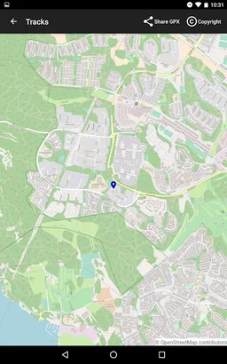
GNSS Viewer can log your position each 1/10/60 second. The resulting track is displayed on a map and can be exported as a GPX file, for example via e-mail.
You can also:
- Clear traveled distance (which also clears the logged tracks)
- Choose between km, miles or nautical miles
- Choose lat/long format (decimal deg, deg/min or deg/min/sec).
- Copy lat/long to clipboard (which also sets a marker on the map, exported in the GPX file).
- Share lat/long, for example via SMS or e-mail.
This app contains no adds. It does not gather, transmit or disclose any personal data.
- Latitude and longitude
- Altitude
- Speed or pace
- Bearing
- UTC time (optional)
- Satellite data (optional).
The app calculates traveled distance as you walk/bicycle/drive.
GNSS Viewer can log your position each 1/10/60 second. The resulting track is displayed on a map and can be exported as a GPX file, for example via e-mail.
You can also:
- Clear traveled distance (which also clears the logged tracks)
- Choose between km, miles or nautical miles
- Choose lat/long format (decimal deg, deg/min or deg/min/sec).
- Copy lat/long to clipboard (which also sets a marker on the map, exported in the GPX file).
- Share lat/long, for example via SMS or e-mail.
This app contains no adds. It does not gather, transmit or disclose any personal data.
Required features
- Faketouch android.hardware.faketouch
- Location android.hardware.location
- Location Gps android.hardware.location.gps
Permissions (6)
GNSS Viewer requests the following Android permissions:
- Access Coarse Location android.permission.ACCESS_COARSE_LOCATION
- Access Fine Location android.permission.ACCESS_FINE_LOCATION
- Access Network State android.permission.ACCESS_NETWORK_STATE
- Access Wifi State android.permission.ACCESS_WIFI_STATE
- Internet android.permission.INTERNET
- Write External Storage android.permission.WRITE_EXTERNAL_STORAGE