
Dresden Transit Maps
Public Transport Network Maps for Dresden. Offline. Reliable. Fast.
Topobyte.de · de.topobyte.transportation.plan.deu.dresden


UpdatedMay 19, 2024
PublishedNov 3, 2020
Packagede.topobyte.transportation.plan.deu.dresden
MD5a3db35a987c7a34fdc712057a0400bc3
SHA1 (signer)AD:3E:21:83:24:25:00:B0:C6:7F:00:50:13:4A:27:BD:B2:1E:75:99
Signed byCN=Sebastian Kürten, OU=Headquarters, O=OpenGeoLab, L=Berlin, ST=Berlin, C=DE
Malware scanTRUSTED
Websitehttp://www.topobyte.de
Contact[email protected]
Description
With this app you have the maps of the public transport system of Dresden always with you.
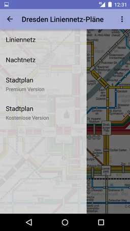
Included plans:
* Transit map
* Night map
Included plans:
* Transit map
* Night map
Required features
- Faketouch android.hardware.faketouch
Permissions (4)
Dresden Transit Maps requests the following Android permissions:
- Access Network State android.permission.ACCESS_NETWORK_STATE
- Internet android.permission.INTERNET
- Com Android Vending Billing com.android.vending.BILLING
- De Topobyte Transportation Plan Deu Dresden Dynamic Receiver Not Exported Permission de.topobyte.transportation.plan.deu.dresden.DYNAMIC_RECEIVER_NOT_EXPORTED_PERMISSION